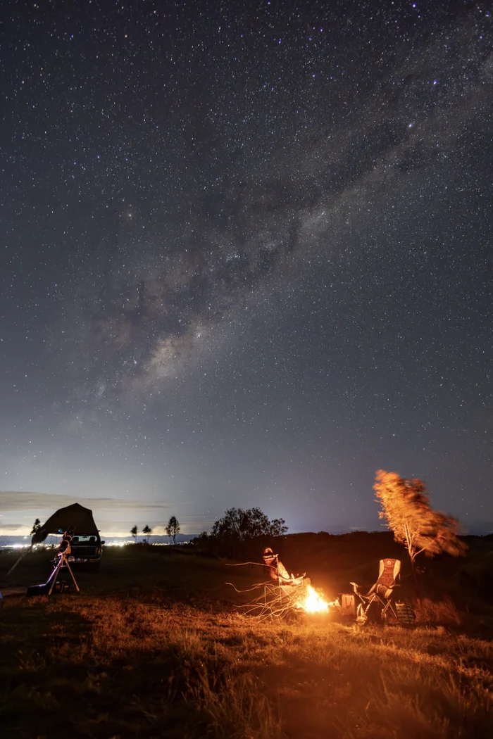
Bromelton, QLD

Juburra Country Camping
A CAMP HAVN COUNTRY experience
About this property
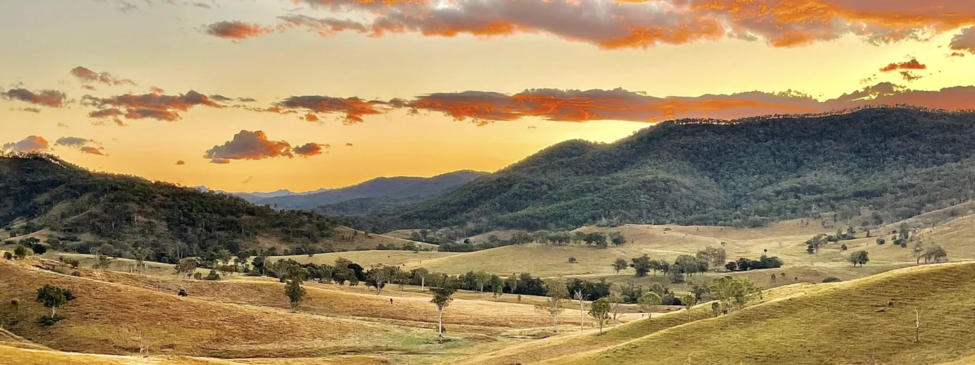
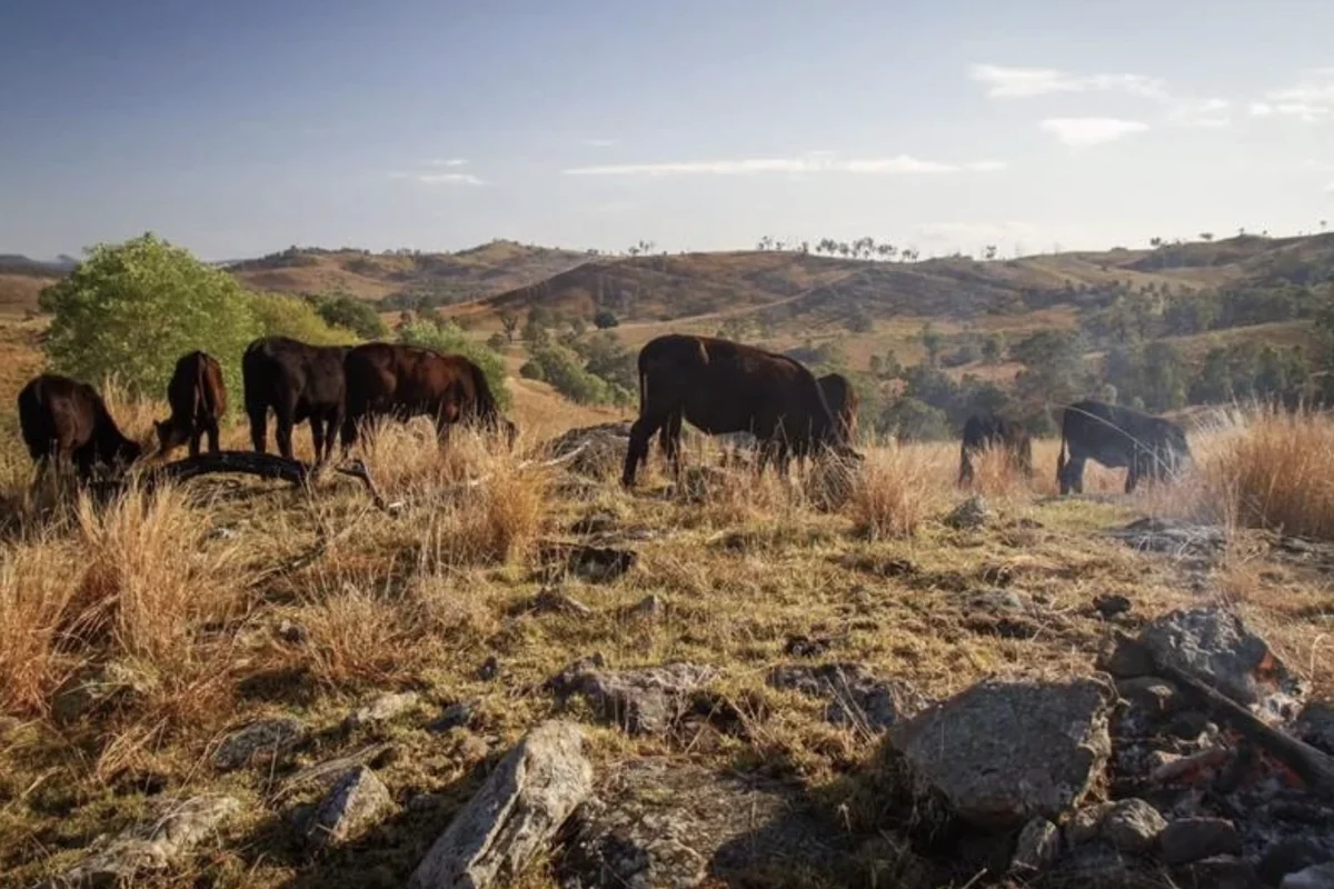
Private camping across 2,100 acres of Queensland cattle country.
Welcome to Juburra
Just over an hour from Brisbane and the Gold Coast, Juburra (pronounced Jew-burra) is where you can leave the crowds behind and experience secluded camping the way it should be.
With hundreds of metres between campsites, Juburra offers the space and privacy to truly switch off. Choose your own escape, whether it's a solo getaway, family adventure, dog-friendly weekend or a trip with friends.
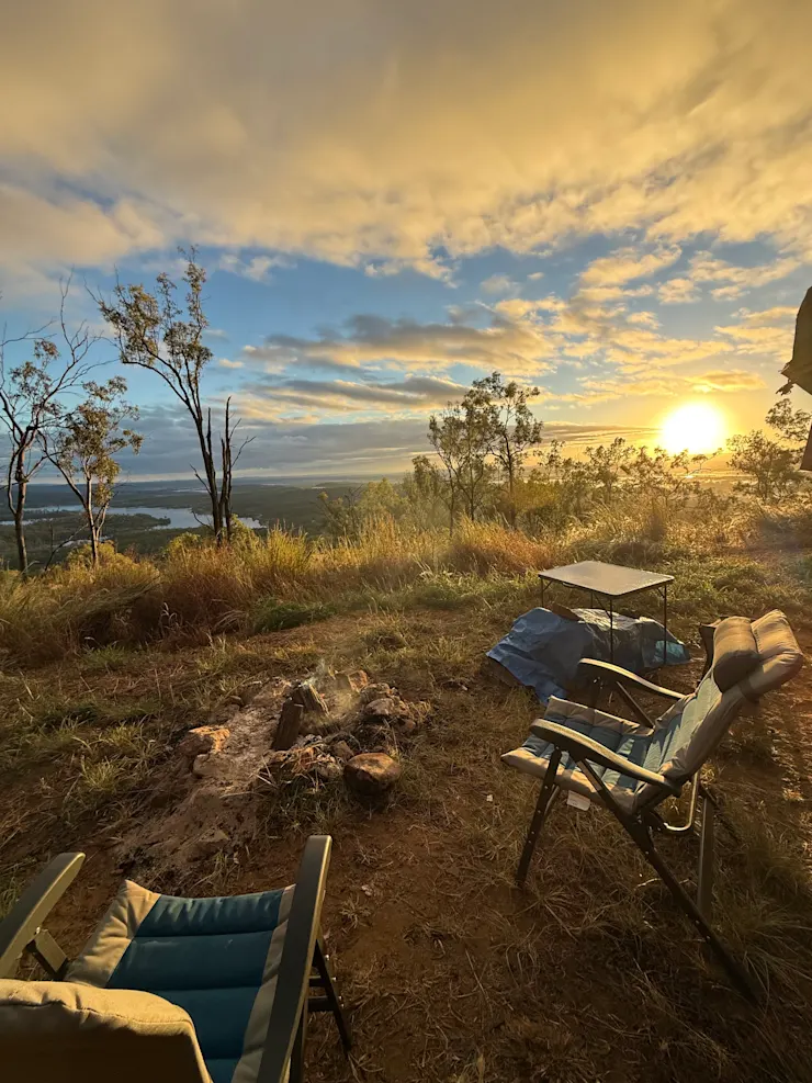
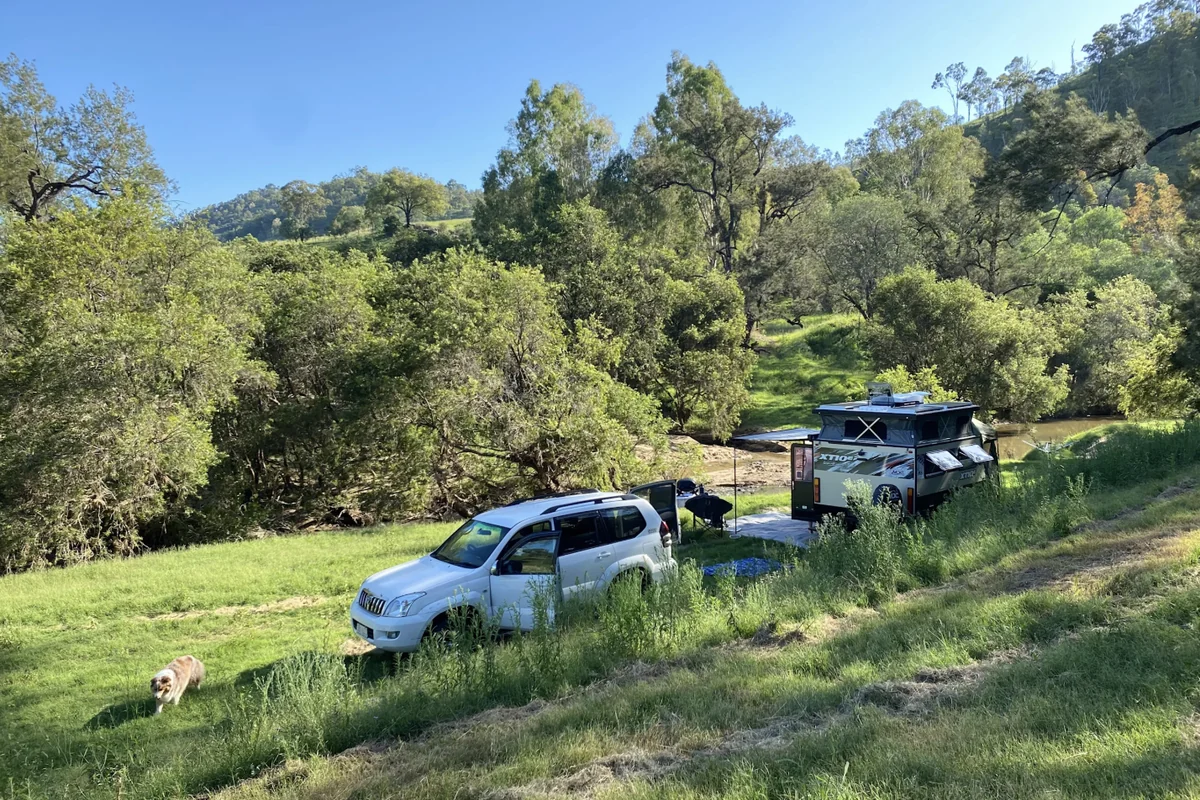
Set on our working cattle property, choose from riverfront camps, peaceful gullies, ridge-top sites and secluded 4WD-only adventures.
Bring the dog, enjoy a campfire under the stars, wake to peaceful mornings, and soak up the quiet of your own private campsite surrounded by nature.
With campsites ranging from easy-access riverfront spots to remote 4WD-only hideaways, it’s easy to see why Juburra has been called “arguably the most diverse campground in the state, if not the country.”
Choose your adventure:
Perfect for large groups, caravans and camper trailers (Look for the 'Access Adventure Rating GREEN' icon in our listings)
River Beach
River Cliffs
The Dog Leg
Cattleman's Corner (our guest favourite)
The Yards
Private campsites for the more adventurous. 4WD recommended, camper trailers welcome (Look for the 'Access Adventure Rating BLUE' icon in our listings)
Squatters Rocks
The Hideout
Westy's Ridge
Rodeo Ridge
Juburra Central
Giants Saddle
Gorge-ous
River Fig
For experienced 4WD adventurers. No trailers! (Look for the 'Access Adventure Rating BLACK' icon in our listings)
Listed from most challenging to easiest access
Point of No Return
The Train Station
Drover's Attick
End of the Road
Stone and Wood
Whether you're looking for an easy weekend escape or an off-grid adventure, there's a campsite waiting for you.
FIND YOUR COUNTRY HAVEN AT JUBURRA.
Stay options
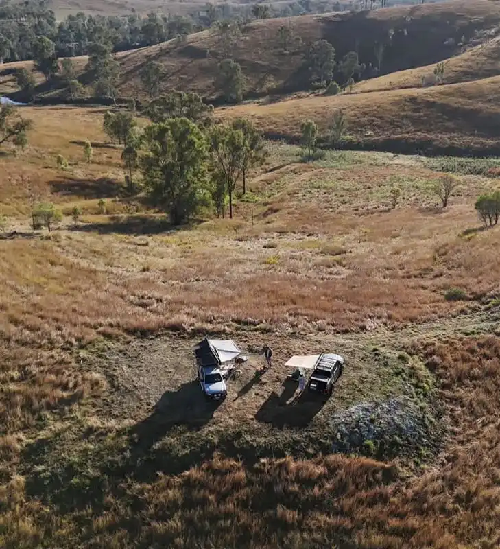
Riverside campsite
$45.00 / night
Sleeps 6 · 22 sites available
Sites22 available
Giant's Saddle
Riverside campsite
$73.00/night
Arrive from 14:00 to 20:00 · leave by 11:00
Heading out of Beaudesert towards Boonah look for the "Aviation Services" gate on the left approximately 600m past Tilley Road which would have been on your right. If you go over Allan Creek bridge, you have gone too far. The gate is about 200m earlier than the bridge. When you go through the Aviation Services gate (please remember to close the gate, there are cows in there somewhere!) From the gate, head directly up the hill towards the small hut on the hill. (this is an aviation navigation facility for the Brisbane Airport) There will be a grassy track that heads up the hill in a straight line towards another gate. (remember to close this gate too please :-) ) Now, check your odometer - we are going to count the meters you travel. From this gate, we head in a southerly direction, past the navigation towers for the next 700m. You will be travelling along a grassy ridge and will come to a steeper climb for the final 100m. At the end of the steep climb you will come onto a new ridge and from there you turn RIGHT and head down the hill following the winding grassy/dirt track for 400m. The campsite is a flat area and has a "Giant's Saddle" sign on a post alongside a carved out, flat campsite. If you have any troubles at all, please give us a call.
Select dates above to book
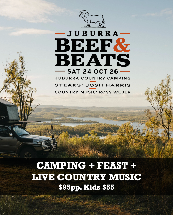
Beef & Beats Communal Area Campsite
Riverside campsite
$95.00/night
Arrive from 14:00 to 16:00 · leave by 11:00
Upper Allan Creek Road starts on the left when you are coming from Beaudesert towards Boonah. The Road entrance has a large, steel white gate which you will need to open and close. Once through the gate, Drive along Upper Allan Creek rd, for 500m until you get to a crest of a hill. Look for "Juburra" handwritten on a white sign on timber post on your left at the crest of the hill. (If you reach the cattleyards on your right you have gone too far - head back to the crest of the hill) Heading past the sign on the post, follow the slashed track over the hill and the River Beach signs to the dam which will be out on your left as you head over the hill. That's where the designated campsite is. For those who wish to park down by the creek, go through the gate opening to the alternate site. Any problems, please sing out!
Select dates above to book
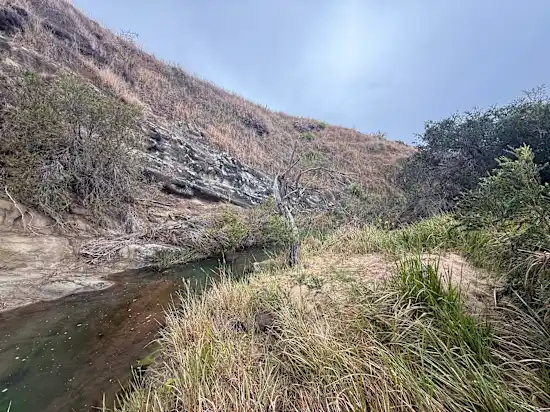
Cow Spa
Riverside campsite
$73.00/night
Arrive from 14:00 to 20:00 · leave by 11:00
Heading out of Beaudesert towards Boonah look for the "Aviation Services" gate on the left approximately 600m past Tilley Road which would have been on your right. If you go over Allan Creek bridge, you have gone too far. The gate is about 200m earlier than the bridge. When you go through the Aviation Services gate (please remember to close the gate, there are cows in there somewhere!) From the Aviataion Services gate, head directly up the hill towards the small hut on the hill. (this is an aviation navigation facility for the Brisbane Airport) There will be a slashed track that heads up the hill in a straight line towards another gate. Go through this gate, remembering to close this gate too please :-) Now, check your odometer - we are going to count the meters you travel. From this gate, you head in a southerly direction, past the navigation towers for the next 700m. You will be travelling along a grassy ridge and will come to a steeper climb for the final 100m. At the end of the steep climb you will come onto a new ridge and see a new landscape open out beyond. From here, continue to head in a southerly direction, following the ridgeline for the next 800m. The ridge has little bends, gradual rises and falls as you drive along. There will be really nice view out on your right across the hills. Beaudesert will be out on your left. As you get to the end of the 800m, you will come across a very flat, roundish platform called Westy's Ridge. Note: Westy's Ridge is another campsite. If no-one is there when you travel through, feel free to stop and admire the view otherwise keep travelling. Traveling on from Westy's Ridge, you continue to head South along the ridge for another 150m until you need to take a turn off the ridge and head down the hill to the right - following an existing dirt track for 250m. Note: This track is quite steep so take it easy. At the bottom of the hill, as it levels out, you will see a set of double gates on your left. If you get to the small dam you've gone too far. Code for the gate is 2512 Go through the double gates and yes, that's right, you'll need to close them when you're through! Once through the gates, turn right and follow the grassy track down the gully for the next 700m. Keep the black (sometime yellow and black) star pickets on your left side as you follow the grassy track, keeping left, heading around the base of the hill. Keep an eye out for the timber sign "Golden Tree," which is where you continue to head for. Once you go past the Golden Tree sign, you will go straight ahead for about 50m until you see the next sign post signaling the site "Cow Spa" is a turn to the left. Follow the slashed track for the next 400m which generally follows the contour of the hill around until it dips down to the creek towards the end. There is a small excavated pad near the creek and sandstone cliffs where you can set up. We hope you enjoy!
Select dates above to book
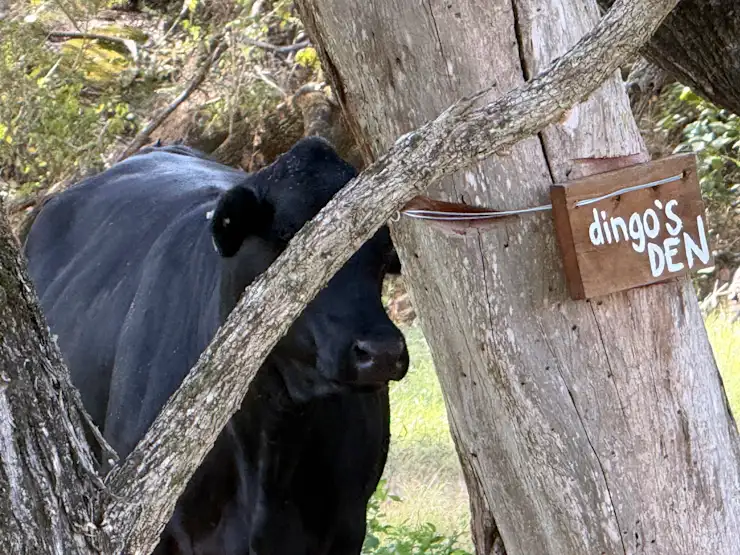
Dingo's Den
Riverside campsite
$85.00/night
Arrive from 14:00 to 20:00 · leave by 11:00
Heading out of Beaudesert towards Boonah look for the "Aviation Services" gate on the left approximately 600m past Tilley Road which would have been on your right. If you go over Allan Creek bridge, you have gone too far. The gate is about 200m earlier than the bridge. When you go through the Aviation Services gate (please remember to close the gate, there are cows in there somewhere!) From the Aviataion Services gate, head directly up the hill towards the small hut on the hill. (this is an aviation navigation facility for the Brisbane Airport) There will be a slashed track that heads up the hill in a straight line towards another gate. Go through this gate, remembering to close this gate too please :-) Now, check your odometer - we are going to count the meters you travel. From this gate, you head in a southerly direction, past the navigation towers for the next 700m. You will be travelling along a grassy ridge and will come to a steeper climb for the final 100m. At the end of the steep climb you will come onto a new ridge and see a new landscape open out beyond. From here, continue to head in a southerly direction, following the ridgeline for the next 800m. The ridge has little bends, gradual rises and falls as you drive along. There will be really nice view out on your right across the hills. Beaudesert will be out on your left. As you get to the end of the 800m, you will come across a very flat, roundish platform called Westy's Ridge. Note: Westy's Ridge is another campsite. If no-one is there when you travel through, feel free to stop and admire the view otherwise keep travelling. Traveling on from Westy's Ridge, you continue to head South along the ridge for another 150m until you need to take a turn off the ridge and head down the hill to the right - following an existing dirt track for 250m. Note: This track is quite steep so take it easy. At the bottom of the hill, as it levels out, you will see a set of double gates on your left. If you get to the small dam you've gone too far. Code for the gate is 2512 Go through the double gates and yes, that's right, you'll need to close them when you're through! Once through the gates, turn right and follow the grassy track down the gully for the next 700m. Keep the black (sometime yellow and black) star pickets on your left side as you follow the grassy track, keeping left, heading around the base of the hill. Keep an eye out for the timber sign "Golden Tree," which is where you are headed for. Once you go past the Golden Tree sign, you will go straight ahead, following the slashed track up to the very top of the next hill, keeping the old tree stumps on your right. (There is some yellow paint on the tree stumps) At the very top of this hill (going around a little, tight S bend on the way up) you will see a cairn (pile of rocks) at the top of the hill. Turn left here, and drive back down the hill for the next 650m. There are a couple of star pickets on the way down, keep them on your left and follow the arrows painted on timber posts to help guide you to the small creek at the bottom. Just before the creek is a small sandy creek and a grassy area called Dingo Den. Any troubles, please let us know as we are always happy to help.
Select dates above to book
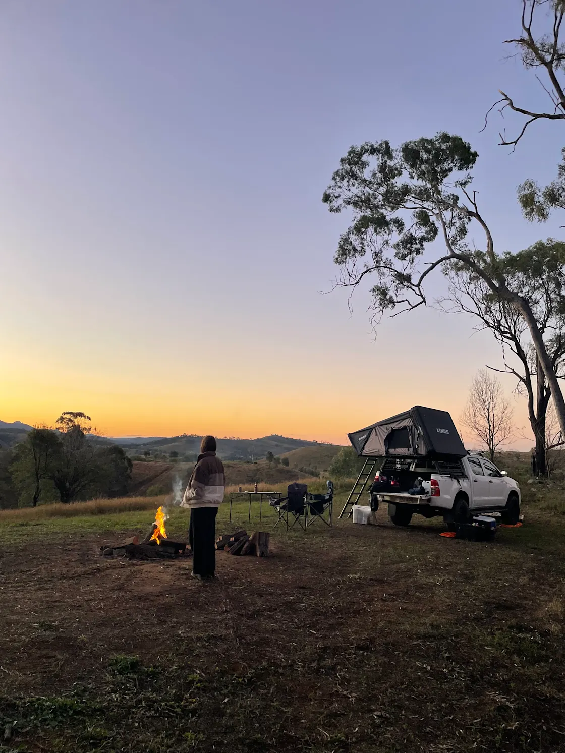
End of the Road
Riverside campsite
$91.00/night
Arrive from 14:00 to 20:00 · leave by 11:00
Heading out of Beaudesert towards Boonah look for the "Aviation Services" gate on the left approximately 600m past Tilley Road which would have been on your right. If you go over Allan Creek bridge, you have gone too far. The gate is about 200m earlier than the bridge. When you go through the Aviation Services gate (please remember to close the gate, there are cows in there somewhere!) From the Aviataion Services gate, head directly up the hill towards the small hut on the hill. (this is an aviation navigation facility for the Brisbane Airport) There will be a slashed track that heads up the hill in a straight line towards another gate. Go through this gate, remembering to close this gate too please :-) Now, check your odometer - we are going to count the meters you travel. From this gate, you head in a southerly direction, past the navigation towers for the next 700m. You will be travelling along a grassy ridge and will come to a steeper climb for the final 100m. At the end of the steep climb you will come onto a new ridge and see a new landscape open out beyond. From here, continue to head in a southerly direction, following the ridgeline for the next 800m. The ridge has little bends, gradual rises and falls as you drive along. There will be really nice view out on your right across the hills. Beaudesert will be out on your left. As you get to the end of the 800m, you will come across a very flat, roundish platform called Westy's Ridge. Note: Westy's Ridge is another campsite. If no-one is there when you travel through, feel free to stop and admire the view otherwise keep travelling. Traveling on from Westy's Ridge, you continue to head South along the ridge for another 150m until you need to take a turn off the ridge and head down the hill to the right - following an existing dirt track for 250m. Note: This track is quite steep so take it easy. At the bottom of the hill, as it levels out, you will see a set of double gates on your left. If you get to the small dam you've gone too far. Code for the gate is 2512 Go through the double gates and yes, that's right, you'll need to close them when you're through! Once through the gates, turn right and follow the grassy track down the gully for the next 700m. Keep the black (sometime yellow and black) star pickets on your left side as you follow the grassy track, keeping left, heading around the base of the hill. Keep an eye out for the timber sign "Golden Tree," which is where you are headed for. Once you go past the Golden Tree sign, you will go straight ahead, following the slashed track up to the very top of the next hill, keeping the old tree stumps on your right. (There is some yellow paint on the tree stumps) At the very top of this hill (going around a little, tight S bend on the way up) you will see a cairn (pile of rocks) at the top of the hill. Turn left here, and drive back down the hill for the next 650m. There are a couple of star pickets on the way down, keep them on your left and follow the arrows painted on timber posts to help guide you to the small creek at the bottom. Just before the creek is a small sandy creek and a grassy area called Dingo Den. Crossing the creek, keeping to the left, head up the dirt track for nearly 100m until you see the next post which directs you to "The Golden Tree" which will have you following the slashed trail all the way up the hill for the next 900m, heading gently up hill all the way to the back fence. There is a sign on the back fence saying "Golden Tree." We call it the Golden Tree becasue often at sunset it turns a golden colour. In the corner of this area there are two gates. Don't take the gate that continues to go up hill - this is not our land. Instead, go through the locked gate with the combination lock - combination is 2601. Closing the gate behind you, follow the slashed trail relatively straight ahead for the next 100m and you'll come to a post with two sites. Straight ahead is the Gorge - eous campsite, but turn right and head down the hill following the slashed trail for the next 1km. You will go through two gullies - the second being a bit of a trickier crossing than the first until you come to a ridge with trees and open areas. This is your campsite "End of the Road" We hope you enjoy! Any troubles, please let us know as we are always happy to help.
Select dates above to book
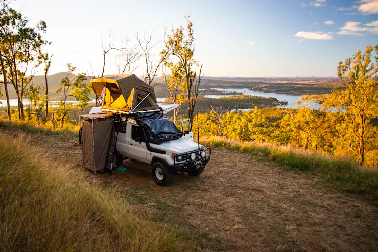
The Train Station
Riverside campsite
$97.00/night
Arrive from 14:00 to 20:00 · leave by 11:00
Go through the white gate onto Upper Allan Creek rd and shut the gate behind you. Continue down Upper Allan Creek Road for 600m until you get to a crest in the road, turn right and follow the slashed track for 750m. You will see the cattle yards off to your left as you follow the trail which leads across a grassy creek bed and up to the ridge. When the trail comes to the top of the ridge at the T intersection turn right and follow the ridge upwards, engage 4WD if you haven't already. In approx 450m of steep climbing you will see a sign indicating left for "The Train Station" or right for "Drovers Attick" keep going straight ahead for another 700m. The road has some flat and steep sections to go. You will come across a chain gate with a combination lock on it. The combination is 2024. You may need to push the lock together to enable it to unlock. Lock it behind you to guarantee your own seclusion. Set up camp, crack open a drink and settle in for changing views of the surrounding landscape.
Select dates above to book
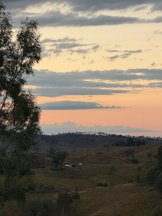
Stone and Wood
Riverside campsite
$85.00/night
Arrive from 14:00 to 20:00 · leave by 11:00
Heading out of Beaudesert towards Boonah look for the "Aviation Services" gate on the left approximately 600m past Tilley Road which would have been on your right. If you go over Allan Creek bridge, you have gone too far. The gate is about 200m earlier than the bridge. When you go through the Aviation Services gate (please remember to close the gate, there are cows in there somewhere!) From the Aviataion Services gate, head directly up the hill towards the small hut on the hill. (this is an aviation navigation facility for the Brisbane Airport) There will be a slashed track that heads up the hill in a straight line towards another gate. Go through this gate, remembering to close this gate too please :-) Now, check your odometer - we are going to count the meters you travel. From this gate, you head in a southerly direction, past the navigation towers for the next 700m. You will be travelling along a grassy ridge and will come to a steeper climb for the final 100m. At the end of the steep climb you will come onto a new ridge and see a new landscape open out beyond. From here, continue to head in a southerly direction, following the ridgeline for the next 800m. The ridge has little bends, gradual rises and falls as you drive along. There will be really nice view out on your right across the hills. Beaudesert will be out on your left. As you get to the end of the 800m, you will come across a very flat, roundish platform called Westy's Ridge. Note: Westy's Ridge is another campsite. If no-one is there when you travel through, feel free to stop and admire the view otherwise keep travelling. Traveling on from Westy's Ridge, you continue to head South along the ridge for another 150m until you need to take a turn off the ridge and head down the hill to the right - following an existing dirt track for 250m. Note: This track is quite steep and if it has been wet it gets greasy so please take it easy. At the bottom of the hill, as it levels out, you will see a set of double gates on your left. If you get to the small dam you've gone too far. Code for the gate is 2512 Go through the double gates and yes, that's right, you'll need to close them when you're through! Once through the gates, turn right and follow the grassy track down the gully for the next 700m. Keep the black (sometime yellow and black) star pickets on your left side as you follow the grassy track. Keeping left, heading around the base of the hill and heading in a slightly down hill direction. Keep an eye out for the timber sign "Boundary Riders," at the bottom of the hill which is where you turn left and head down and wind through a small creek crossing. When you wind back out of the creek crossing, as you come back up the other side, keep an eye out for the next sign saying "Boundary Riders" that will have you heading up the hill for the next 200m until you get to a gate with "Back 5 Mile" written on it. Go through this gate, combination 0101 and PLEASE close it :-) Follow the track for 200m as it comes to a gully with a small dam and tall eucalypts. Stick to the right of the dam and cross the gully. As you climb out of the rocky gully and come to the top of that climb there should be a post with two signs. One saying "Stone and Wood" the other saying "Point of No Return" Head up the track to the left, following the ridge all the way to the top. There are a few rocky ledges and the end to climb over but you'll drop down onto a pad and this is your campsite! We hope you enjoy - please call if you have any problems.
Select dates above to book
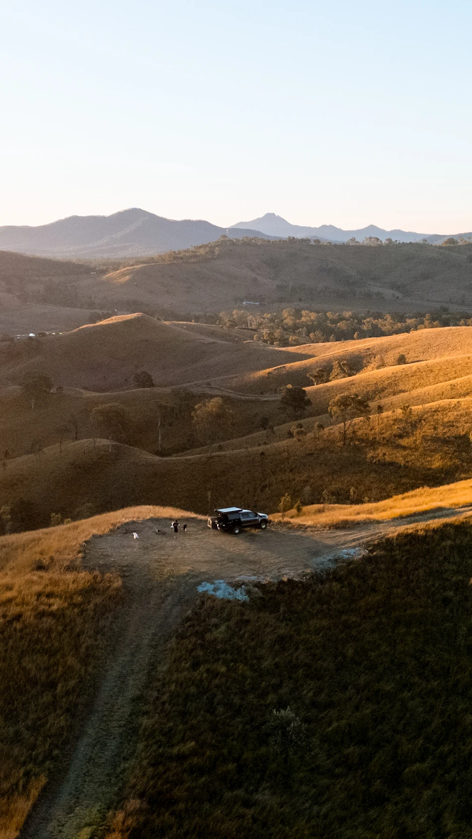
Westy's Ridge
Riverside campsite
$85.00/night
Arrive from 14:00 to 20:00 · leave by 11:00
Select dates above to book
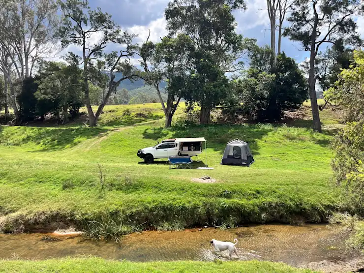
Cattleman's Corner
Riverside campsite
$180.00/night
Arrive from 14:00 to 20:00 · leave by 11:00
Go through the white gate onto Upper Allan Creek rd, (not signposted as a rd) follow till you pass the cattle yards on your right, then go about 500m till you go over a cattle grid. Just after the grid, veer off to the left and head across the paddock to the site. Look out for the dead tree with Cattleman's Corner sign at the base.
Select dates above to book
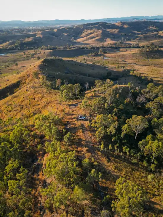
Drover's Attick
Riverside campsite
$85.00/night
Arrive from 14:00 to 20:00 · leave by 11:00
Go through the white gate onto Upper Allan Creek rd and shut the gate behind you. Continue down Upper Allan Creek Road for 600m until you get to a crest in the road, turn right and follow the slashed track for 750m. You will see the cattle yards off to your left as you follow the trail which leads across a grassy creek bed and up to the ridge. When the trail comes to the top of the ridge at the T intersection turn right and follow the ridge upwards, engage 4WD if you haven't already. In approx 450m of steep climbing you will see a sign indicating left for "The Train Station" or right for "Drovers Attick" Take the right hand turn and head downwards into the Drovers Attick. Hope you enjoy!
Select dates above to book
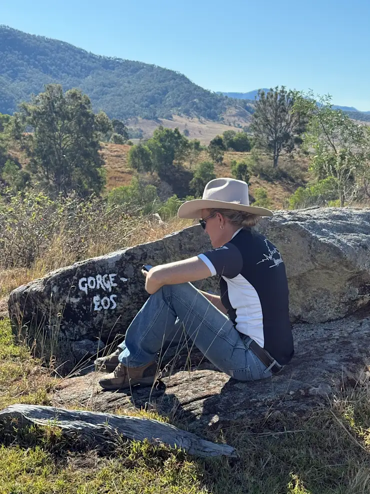
Gorge-ous
Riverside campsite
$91.00/night
Arrive from 14:00 to 20:00 · leave by 11:00
Heading out of Beaudesert towards Boonah look for the "Aviation Services" gate on the left approximately 600m past Tilley Road which would have been on your right. If you go over Allan Creek bridge, you have gone too far. The gate is about 200m earlier than the bridge. When you go through the Aviation Services gate (please remember to close the gate, there are cows in there somewhere!) From the Aviation Services gate, head directly up the hill towards the small hut on the hill. (this is an aviation navigation facility for the Brisbane Airport) There will be a slashed track that heads up the hill in a straight line towards another gate. Go through this gate, remembering to close this gate too please :-) Now, check your odometer - we are going to count the meters you travel. From this gate, you head in a southerly direction, past the navigation towers for the next 700m. You will be travelling along a grassy ridge and will come to a steeper climb for the final 100m. At the end of the steep climb you will come onto a new ridge and see a new landscape open out beyond. From here, continue to head in a southerly direction, following the ridgeline for the next 800m. The ridge has little bends, gradual rises and falls as you drive along. There will be really nice view out on your right across the hills. Beaudesert will be out on your left. As you get to the end of the 800m, you will come across a very flat, roundish platform called Westy's Ridge. Note: Westy's Ridge is another campsite. If no-one is there when you travel through, feel free to stop and admire the view otherwise keep travelling. Traveling on from Westy's Ridge, you continue to head South along the ridge for another 150m until you need to take a turn off the ridge and head down the hill to the right - following an existing dirt track for 250m. Note: This track is quite steep so take it easy. At the bottom of the hill, as it levels out, you will see a set of double gates on your left. If you get to the small dam you've gone too far. Code for the gate is 2512 Go through the double gates and yes, that's right, you'll need to close them when you're through! Once through the gates, turn right and follow the grassy track down the gully for the next 700m. Keep the black (sometime yellow and black) star pickets on your left side as you follow the grassy track, keeping left, heading around the base of the hill. Keep an eye out for the timber sign "Golden Tree," which is where you are headed for. Once you go past the Golden Tree sign, you will go straight ahead, following the slashed track up to the very top of the next hill, keeping the old tree stumps on your right. (There is some yellow paint on the tree stumps) At the very top of this hill (going around a little, tight S bend on the way up) you will see a cairn (pile of rocks) at the top of the hill. Turn left here, and drive back down the hill for the next 650m. There are a couple of star pickets on the way down, keep them on your left and follow the arrows painted on timber posts to help guide you to the small creek at the bottom. Just before the creek is a small sandy creek and a grassy area called Dingo Den. Crossing the creek, keeping to the left, head up the dirt track for nearly 100m until you see the next post which directs you to "The Golden Tree" which will have you following the slashed trail all the way up the hill for the next 900m, heading gently up hill all the way to the back fence. There is a sign on the back fence saying "Golden Tree." We call it the Golden Tree becasue often at sunset it turns a golden colour. In the corner of this area there are two gates. Don't take the gate that continues to go up hill - this is not our land. Instead, go through the locked gate with the combination lock - combination is 2601. Closing the gate behind you, follow the slashed trail relatively straight ahead for the next 100m and you'll come to a post with two sites. 200m straight ahead is the Gorge - eous campsite. This is your campsite and we hope you enjoy! Any troubles, please let us know as we are always happy to help.
Select dates above to book
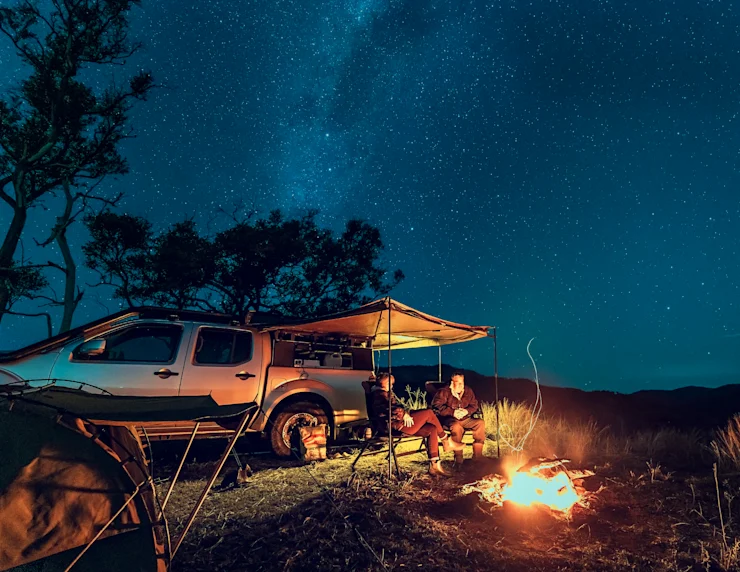
Juburra Central
Riverside campsite
$85.00/night
Arrive from 14:00 to 20:00 · leave by 11:00
Heading out of Beaudesert towards Boonah look for the "Aviation Services" gate on the left approximately 600m past Tilley Road which would have been on your right. If you go over Allan Creek bridge, you have gone too far. The gate is about 200m earlier than the bridge. When you go through the Aviation Services gate (please remember to close the gate, there are cows in there somewhere!) From the Aviataion Services gate, head directly up the hill towards the small hut on the hill. (this is an aviation navigation facility for the Brisbane Airport) There will be a slashed track that heads up the hill in a straight line towards another gate. Go through this gate, remembering to close this gate too please :-) Now, check your odometer - we are going to count the meters you travel. From this gate, you head in a southerly direction, past the navigation towers for the next 700m. You will be travelling along a grassy ridge and will come to a steeper climb for the final 100m. At the end of the steep climb you will come onto a new ridge and see a new landscape open out beyond. From here, continue to head in a southerly direction, following the ridgeline for the next 800m. The ridge has little bends, gradual rises and falls as you drive along. There will be really nice view out on your right across the hills. Beaudesert will be out on your left. As you get to the end of the 800m, you will come across a very flat, roundish platform called Westy's Ridge. Note: Westy's Ridge is another campsite. If no-one is there when you travel through, feel free to stop and admire the view otherwise keep travelling. Traveling on from Westy's Ridge, you continue to head South along the ridge for another 150m until you need to take a turn off the ridge and head down the hill to the right - following an existing dirt track for 250m. Note: This track is quite steep so take it easy. At the bottom of the hill, as it levels out, you will see a set of double gates on your left. If you get to the small dam you've gone too far. Opposite the double gates, on your left (as you had come down the hill,) you will see a slashed track heading up the hill. This is the exclusive entrance to Juburra Central campsite. Follow the track to the top of the hill and head west down the line of the ridge for about 650m until you come to the campsite - it will have a sign "Juburra Central" nailed to a tree.
Select dates above to book
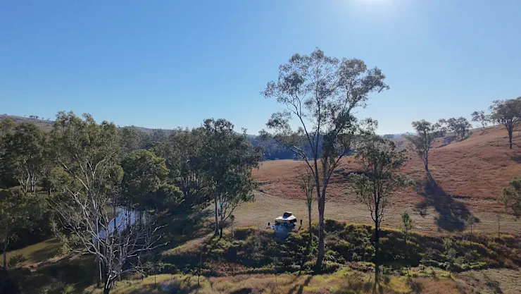
River Cliffs
Riverside campsite
$85.00/night
Arrive from 14:00 to 20:00 · leave by 11:00
Heading out of Beaudesert towards Boonah look for the "Aviation Services" gate on the left approximately 600m past Tilley Road which would have been on your right. If you go over Allan Creek bridge, you have gone too far. The gate is about 200m earlier than the bridge. When you go through the Aviation Services gate (please remember to close the gate, there are cows in there somewhere!) follow the fence on your immediate right towards the creek and follow the meandering sandstone road down towards the lower flats. Take it easy on this road, it is narrow and a touch rough and it is a long drop down on your right! When you get to the bottom of the sandstone road continue along the wide slashed track for another 500m (heading up river) until you get to the next gate. The slashed track follows the toe of the hill. Go through this gate (remembering to close it behind you) and there is your site! It's a large area anywhere from the gate up to the dam. Help yourself to the spot you like the best.
Select dates above to book
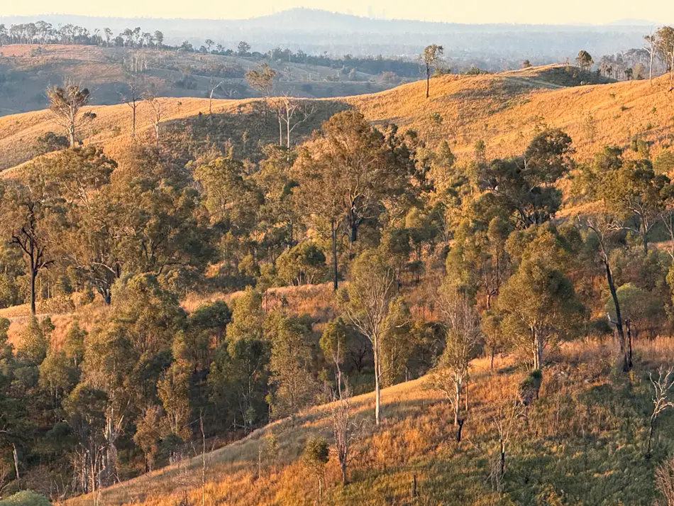
Point of No Return
Riverside campsite
$85.00/night
Arrive from 14:00 to 20:00 · leave by 11:00
Heading out of Beaudesert towards Boonah look for the "Aviation Services" gate on the left approximately 600m past Tilley Road which would have been on your right. If you go over Allan Creek bridge, you have gone too far. The gate is about 200m earlier than the bridge. When you go through the Aviation Services gate (please remember to close the gate, there are cows in there somewhere!) From the Aviataion Services gate, head directly up the hill towards the small hut on the hill. (this is an aviation navigation facility for the Brisbane Airport) There will be a slashed track that heads up the hill in a straight line towards another gate. Go through this gate, remembering to close this gate too please :-) Now, check your odometer - we are going to count the meters you travel. From this gate, you head in a southerly direction, past the navigation towers for the next 700m. You will be travelling along a grassy ridge and will come to a steeper climb for the final 100m. At the end of the steep climb you will come onto a new ridge and see a new landscape open out beyond. From here, continue to head in a southerly direction, following the ridgeline for the next 800m. The ridge has little bends, gradual rises and falls as you drive along. There will be really nice view out on your right across the hills. Beaudesert will be out on your left. As you get to the end of the 800m, you will come across a very flat, roundish platform called Westy's Ridge. Note: Westy's Ridge is another campsite. If no-one is there when you travel through, feel free to stop and admire the view otherwise keep travelling. Traveling on from Westy's Ridge, you continue to head South along the ridge for another 150m until you need to take a turn off the ridge and head down the hill to the right - following an existing dirt track for 250m. Note: This track is quite steep and if it has been wet it gets greasy so please take it easy. At the bottom of the hill, as it levels out, you will see a set of double gates on your left. If you get to the small dam you've gone too far. Code for the gate is 2512 Go through the double gates and yes, that's right, you'll need to close them when you're through! Once through the gates, turn right and follow the grassy track down the gully for the next 700m. Keep the black (sometime yellow and black) star pickets on your left side as you follow the grassy track. Keeping left, heading around the base of the hill and heading in a slightly down hill direction. Keep an eye out for the timber sign "Boundary Riders," at the bottom of the hill which is where you turn left and head down and wind through a small creek crossing. When you wind back out of the creek crossing, as you come back up the other side, keep an eye out for the next sign saying "Boundary Riders" that will have you heading up the hill for the next 200m until you get to a gate with "Back 5 Mile" written on it. Go through this gate, combination 0101 and PLEASE close it :-) Follow the track for 200m as it comes to a gully with a small dam and tall eucalypts. Stick to the right of the dam and cross the gully. As you climb out of the rocky gully and come to the top of that climb there should be a post with two signs. One saying "Stone and Wood" the other saying "Point of No Return" Head straight ahead, you've still got another 1.2km's to go and follow the track as it winds along, following the creek up into the foothills. Keep an eye out for a gully that has "Base Camp" posted to a tree. This is the last of the gentle ride and the start of the climb. If it is getting dark, or the weather is foul, we suggest hanging in Base Camp for the night as it is a peaceful and sheltered site for the exclusive use of "Point of No Return" guests. If you want to keep going, lock in 4wd, diffs and hold onto the Jesus bar. The track comes to the end at the very, very top of the road. Enjoy the views and if you get stuck please call us.
Select dates above to book
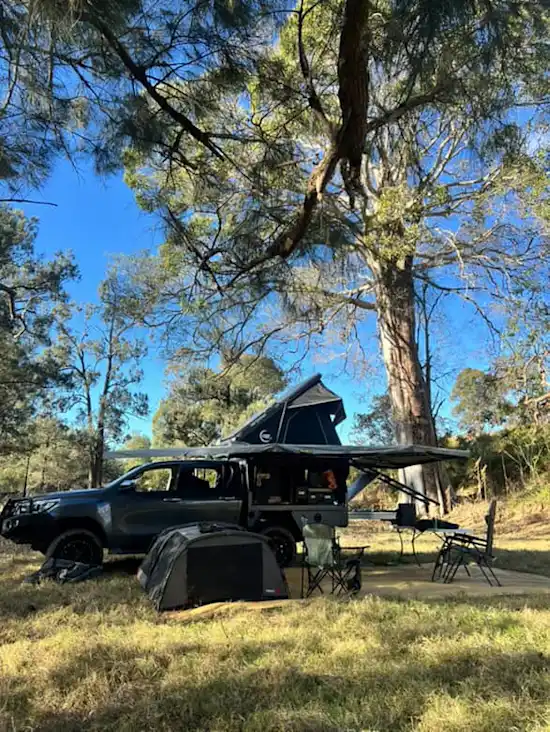
River Fig
Riverside campsite
$115.00/night
Arrive from 14:00 to 20:00 · leave by 11:00
Select dates above to book
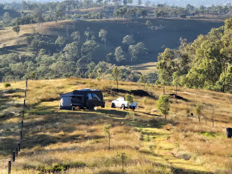
The Hideout
Riverside campsite
$73.00/night
Arrive from 14:00 to 20:00 · leave by 11:00
Select dates above to book
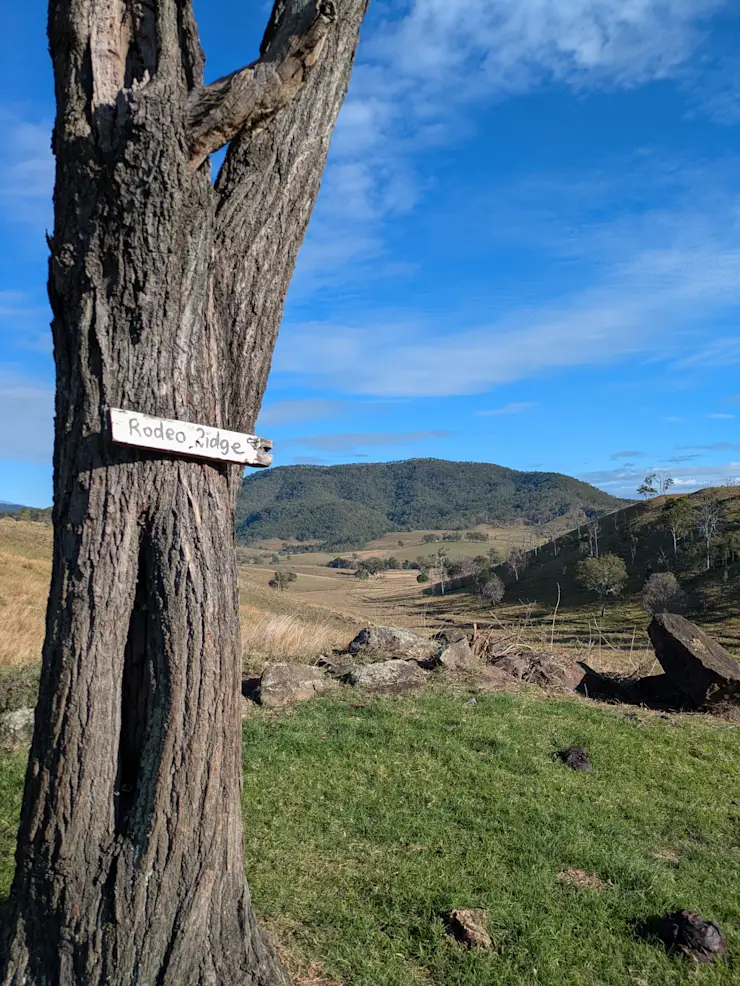
Rodeo Ridge
Riverside campsite
$73.00/night
Arrive from 14:00 to 20:00 · leave by 11:00
Heading out of Beaudesert towards Boonah look for the "Aviation Services" gate on the left approximately 600m past Tilley Road which would have been on your right. If you go over Allan Creek bridge, you have gone too far. The gate is about 200m earlier than the bridge. When you go through the Aviation Services gate (please remember to close the gate, there are cows in there somewhere!) From the Aviataion Services gate, head directly up the hill towards the small hut on the hill. (this is an aviation navigation facility for the Brisbane Airport) There will be a slashed track that heads up the hill in a straight line towards another gate. Go through this gate, remembering to close this gate too please :-) Now, check your odometer - we are going to count the meters you travel. From this gate, you head in a southerly direction, past the navigation towers for the next 700m. You will be travelling along a grassy ridge and will come to a steeper climb for the final 100m. At the end of the steep climb you will come onto a new ridge and see a new landscape open out beyond. From here, continue to head in a southerly direction, following the ridgeline for the next 800m. The ridge has little bends, gradual rises and falls as you drive along. There will be really nice view out on your right across the hills. Beaudesert will be out on your left. As you get to the end of the 800m, you will come across a very flat, roundish platform called Westy's Ridge. Note: Westy's Ridge is another campsite. If no-one is there when you travel through, feel free to stop and admire the view otherwise keep travelling. Traveling on from Westy's Ridge, you continue to head South along the ridge for another 150m until you need to take a turn off the ridge and head down the hill to the right - following an existing dirt track for 250m. Note: This track is quite steep so take it easy. At the bottom of the hill, as it levels out, you will see a set of double gates on your left. If you get to the small dam you've gone too far. Go through the double gates code 2512 and yes, that's right, you'll need to close them when you're through! Once through the gates, follow the fenceline on your left and head up to the top of the hill and take a turn to the right. There is a flat area by some trees with the sign "Rodeo Ridge" indicating where the campsite is. Any troubles, please let us know as we are always happy to help.
Select dates above to book
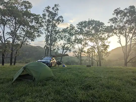
The Yards
Riverside campsite
$43.00/night
Arrive from 14:00 to 20:00 · leave by 11:00
Select dates above to book
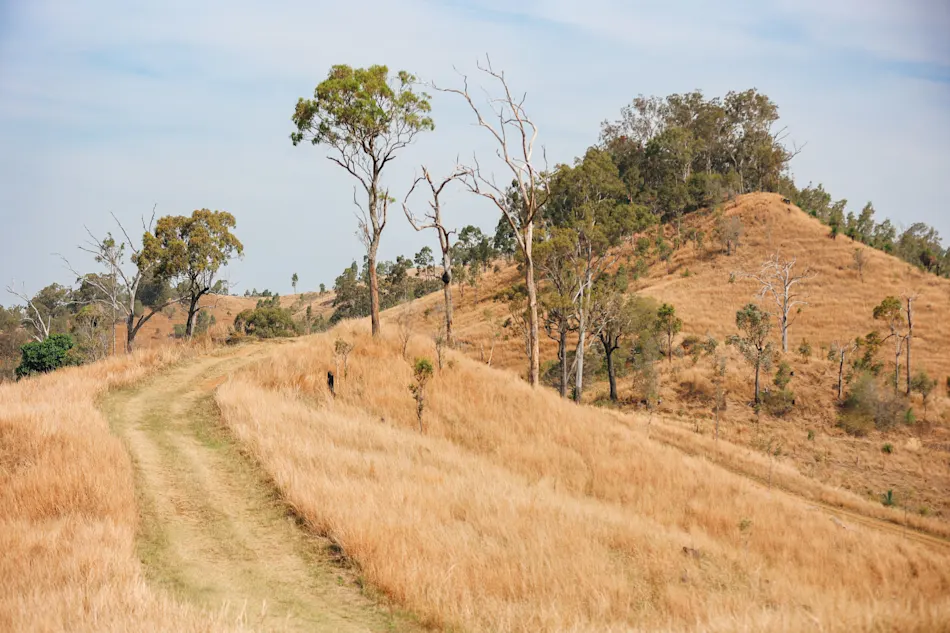
The Golden Tree
Riverside campsite
$91.00/night
Arrive from 14:00 to 20:00 · leave by 11:00
Select dates above to book
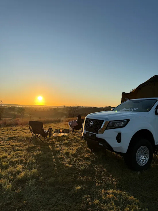
Squatter's Rocks
Riverside campsite
$37.00/night
Arrive from 14:00 to 20:00 · leave by 11:00
When you arrive at Upper Allan Creek Road you will come to a closed white gate. Please close the gate when you have passed through. Continue down Upper Allan Creek Road for 600m until you get to a crest in the road, turn right and follow the slashed track for 750m. You will see the cattle yards off to your left as you follow the trail which leads across a grassy creek bed and up to the ridge. When the trail comes to the top (after 750m) of a ridge amongst some trees, turn left (don't turn right, that is a 4WD track leading to another campsite called Drover's Attick) and follow the slashed trail for another 170m to the cleared pad. Enjoy!
Select dates above to book
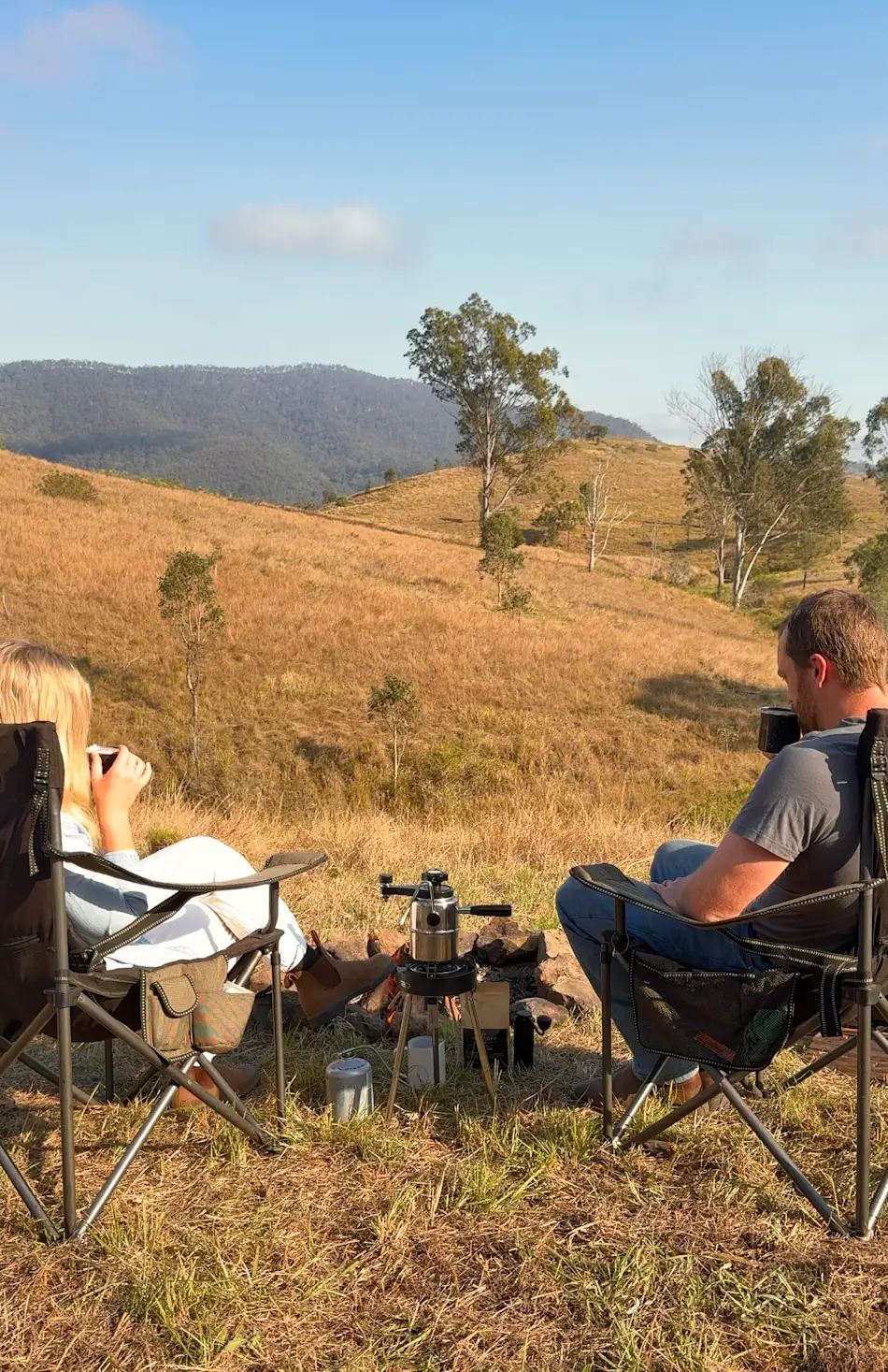
Boundary Riders
Riverside campsite
$73.00/night
Arrive from 14:00 to 20:00 · leave by 11:00
Heading out of Beaudesert towards Boonah look for the "Aviation Services" gate on the left approximately 600m past Tilley Road which would have been on your right. If you go over Allan Creek bridge, you have gone too far. The gate is about 200m earlier than the bridge. When you go through the Aviation Services gate (please remember to close the gate, there are cows in there somewhere!) From the Aviataion Services gate, head directly up the hill towards the small hut on the hill. (this is an aviation navigation facility for the Brisbane Airport) There will be a slashed track that heads up the hill in a straight line towards another gate. Go through this gate, remembering to close this gate too please :-) Now, check your odometer - we are going to count the meters you travel. From this gate, you head in a southerly direction, past the navigation towers for the next 700m. You will be travelling along a grassy ridge and will come to a steeper climb for the final 100m. At the end of the steep climb you will come onto a new ridge and see a new landscape open out beyond. From here, continue to head in a southerly direction, following the ridgeline for the next 800m. The ridge has little bends, gradual rises and falls as you drive along. There will be really nice view out on your right across the hills. Beaudesert will be out on your left. As you get to the end of the 800m, you will come across a very flat, roundish platform called Westy's Ridge. Note: Westy's Ridge is another campsite. If no-one is there when you travel through, feel free to stop and admire the view otherwise keep travelling.
Select dates above to book
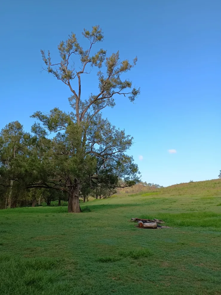
The Dog Leg
Riverside campsite
$85.00/night
Arrive from 14:00 to 20:00 · leave by 11:00
Select dates above to book
What to expect
Amenities
Things to know
Getting here
Check-in
After 2:00 PM
Check-out
Before 10:00 AM
Address
Provided after booking
Minimum stay
1 night
During your stay
Hosted by Haven
CAMP HAVN